
THE PARK

THE ASTROPARK

STOP 1: SUNDIAL

We will stop to take a look at the sundial. This instrument consists of a flat rock with a vertical dent and an inclination that replicates the tilt of the Earth’s axis. As you can see, the flat rock is surrounded by a metal ring with Roman numbers. The workings of this sundial are simple: the shadow cast on the dent by the metal ring indicates the current time.

The Earth’s rotation generates an apparent motion of the Sun in the sky. Each morning the sun rises in the East and sets in the West at sunset. In its trajectory, the sun shines over the metal ring and projects the shadow of the numbers on the dial over the rock. As the sun moves across the sky, the shadow moves across the numbers on the dial. 

You may find it strange that the number 1 is located vertically over the sundial. This is because this «sun clock» shows the civil time and not the solar time, as the sun is directly above Córdoba at exactly 1.30 p.m.

STOP 2: PARK OF THE SOLSTICES AND EQUINOXES

We are standing before the Park of the Solstices and the Equinoxes. With this antique astronomical instrument, we can measure the passing of time by watching the sunlight and the shadows it projects.

On the ground, there is a circular platform with the legends: midday, morning, afternoon, solstice, equinox, and the four seasons. In the center, there is a tilted bar with a sphere on the tip, called a gnomon.

A gnomon is any object whose shadow helps us ascertain the position of the Sun in the sky. Throughout the day and the year, its shadow travels over the surface of the circle, showing the seasons and the time of day.

This gnomon has a particular inclination: it points in the same direction as the Earth’s axis of rotation. Thus, the shadow falls on different quadrants which combine the seasons (winter-summer, spring-autumn) and the time of day (morning or afternoon).

For example, on an autumn or winter morning, the shadow will fall over the upper right quadrant. However, during a spring or summer afternoon, the shadow will fall on the lower left quadrant.

Those changes in the position of the shadow are a result of the translational motion of the Earth, that is, the journey as it travels around the Sun during the year. As the Earth’s axis is tilted, the sunlight impacts each hemisphere throughout the year in a different way, creating the seasons.

When the summer is in the Southern Hemisphere, this hemisphere is tilted toward the sun, and the sun’s rays shine more directly. Simultaneously, it is winter in the Northern Hemisphere because the sun’s rays arrive at a more inclined angle. During the equinoxes, the phenomenon levels up: the sun shines equally on both hemispheres and its light falls perpendicularly over the Equator. On that day, the shadow of the gnomon falls right over the line marked as «Equinox.»

However, during the solstices, the shadow reaches key points: around midday on June 21, when the winter solstice takes place in the Southern Hemisphere, the gnomon’s shadow is the longest of the year and reaches the line on the winter solstice. Around December 21, during the summer solstice, the shadow at midday is the shortest of the year and falls over the opposite line, on the summer solstice. These markings show the times of year when the Sun reaches its lowest or highest point in the sky at midday.

STOP 3: THE PARALLEL GLOBE

Globo Terráqueo Paralelo

We will stop to take a look at the sundial. This instrument consists of a flat rock with a vertical dent and an inclination that replicates the tilt of the Earth’s axis. As you can see, the flat rock is surrounded by a metal ring with Roman numbers. The workings of this sundial are simple: the shadow cast on the dent by the metal ring indicates the current time.

The parallel globe shows a different perspective from other more common globes. In this globe, Córdoba is located at the highest point, and the axis of rotation points towards the South Celestial Pole, which is an imaginary point that marks the intersection between the Earth’s axis and the sphere that represents the sky.

We continue moving forward through the Square. Let’s go to the Learning Interactive Area.

LEARNING INTERACTIVE AREA

This area was designed to give you an interactive experience and help you understand, through observation and experimentation, some of the fundamental principles of physics, such as motion and force.

STOP 4: ARCHIMEDES' SCREW

Archimedes’ screw is a mechanical device invented by the Greeks, and it is considered to be the first ever water pump. This endless screw is turned manually by rotating the wheel at the top end. When rotating the wheel, the water moves up from the bottom end of the screw. 

This device is still in use today. For example, it is widely used in agriculture, in grain elevators.

STOP 5: PULLEYS AND LEVERS

Pulleys and levers are devices that help lift heavy objects with less effort. 

A pulley is a wheel with a rope threaded through it. It is used to raise or lower objects with ease. The more pulleys a system has, the less force is needed to move the object, but you have to pull the rope for a longer time.

A lever is a bar that rests on a fixed point. Using a lever, you can move heavy objects with less effort as well. Some examples of levers in everyday life are see-saws, a pair of scissors, or even a door.

What is interesting about these devices is that, although it looks as though less effort is involved, they do not reduce the total energy needed. What they do is distribute the effort: less force is applied, but over a longer distance.

STOP 6: NEWTON'S CRADLE

We are now standing before Newton´s cradle, a device that enables us to clearly visualize some fundamental principles of physics.

It consists of a series of identical, rigid, and heavy spheres —generally five— suspended in a line, and in direct contact with each other.

This device illustrates how energy behaves in elastic collisions, that is, those in which energy is not lost in the form of heat or deformation. Here, two key principles can be observed: energy transfer and the conservation of total energy.


If we pull back one of the spheres from one end and release it from a certain height, it will hit the next sphere and stop almost completely. The balls in the middle will remain apparently motionless, and only the ball on the opposite side will swing out, which will be propelled to approximately the same height as the first ball.

Then, this ball will fall back and hit the rest, repeating the process in the opposite direction.


If we pull and release two balls instead of one, we will see the same number of balls swing out on the opposite side, while the others remain motionless.

THE GEOPARK

STOP 7: FOOTPRINT PARK

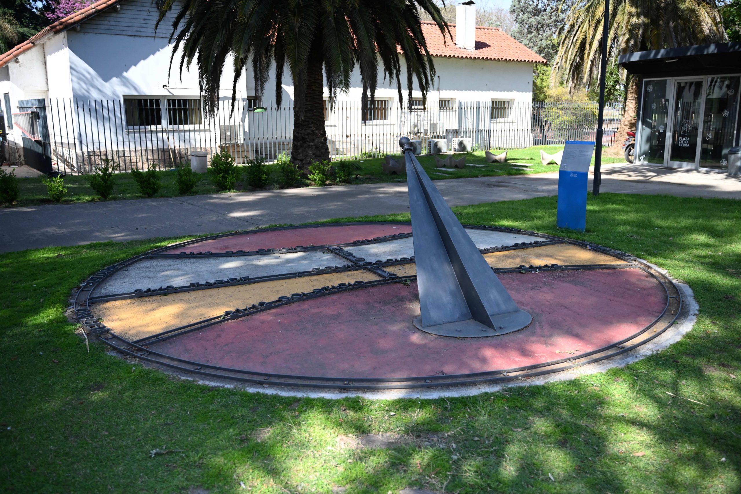
In the Footprint Park, ichnite representations, that is, fossil footprints of prehistoric animals, can be found. Here, these ichnites belong to animals that lived in South America, and other footprints of living animals are represented.

We invite you to come and stand near the footprints to learn about each one of them. Please, do not step on them because they can break. 

The footprints in pink correspond to dinosaurs that lived during the Mesozoic Era, in what we now know as Latin America.
Among them, the Argentinosaurus stands out. It is one of the largest known herbivorous dinosaurs. It could reach up to 40 m (0.2 mi) in length and an estimated weight of between 70 and 80 t (or 154,323.58 lb and 176,369.81 lb). Its extremely long neck made it possible for this dinosaur to access high vegetation, feeding on treetops.

Another remarkable specimen is the Giganotosaurus carolinii, a carnivorous dinosaur that is also among the largest of its kind. This predator had powerful jaws with sharp teeth and a robust body structure, making it a very efficient hunter. It is estimated that it reached up to 15 m (0.01 mi) in length and weighed around 7 t (15,432.36 lb).

Footprints of an ornithopod dinosaur are also represented here. Ornithopods were a group of herbivores characterized by their horny beak, short neck, and three-toed feet, similar to those of birds.
Among the medium-sized carnivores, we have the Herrerasaurus, a medium-sized bipedal dinosaur with curved, pointed teeth, short arms, and hands with claws, adapted for holding and tearing its prey.

Another animal represented in the park is the Eoraptor, a small carnivorous dinosaur of approximately 1 m (3.28 ft) long, which fed on reptiles, small mammals, and insects.

Lastly, a representation of a Pterosaur has also been included. It was a flying reptile that was not a dinosaur but lived alongside them. It was characterized by membrane wings and a light skeleton with hollow bones, which enabled it to fly with great efficiency. Their diet was varied: from insects and fish to small land animals.

Continuing the tour, we find representations of footprints belonging to animals that lived in the Cenozoic Era, during which the large mammals that inhabited this region emerged after the extinction of the dinosaurs. This fauna, known as South American megafauna, consisted of large animals that populated the territories that today correspond to Argentina.

One of the most emblematic was the Glyptodon, an armored herbivorous mammal, related to today’s armadillos. The Glyptodon´s body was protected by a rounded shell, formed by bony plates, and it had short limbs adapted to support its heavy weight. Some specimens reached up to 3 m (9.84 ft) in length and weighed over a ton. Its appearance resembled that of a tortoise, although it was a mammal.

Another giant creature of this era was the Megatherium, a ground sloth of huge proportions. It had a very robust bony structure, with a wide pelvis, and a muscular tail used as a third point of support to stand up. Thus, it was able to support its huge body on its hind legs and reach tall branches with its long arms and curved claws. It reached up to over 6 m (19.69 ft) in length and weighed over 3 t (6,613.87 lb).

The Macrauchenia was another typical inhabitant of this era. It had a particular appearance, resembling a humpless camel, with a long neck and a short snout. It measured around 3 m (9.84 ft) in length, 2 m (6.56 ft) in height, and could weigh up to 1,500 kg (3,306.93 lb). It was a herbivore that fed on grassland and floodplain areas. This specimen was native to South America and extensively inhabited the prehistoric Pampas plain, covering the regions that today include the provinces of Buenos Aires, Córdoba, Santa Fe, La Pampa, Entre Ríos, and San Luis. It had contact with early humans, which probably contributed to its extinction.

Also represented is the Paleolama, an extinct camelid of approximately 2 m (6.56 ft) long and tall, with herbivorous habits. It is believed that its extinction was related to human hunting.

Lastly, we have footprints of the Stegomastodon, a large herbivorous mammal related to the modern elephant. It was around 3 m (9.84 ft) tall and weighed more than 5 t (11,023.11 lb). Its diet was based mainly on grass, although it also fed on tree sprouts and various vegetables found in its habitat.


As we approach the pavilion, we find footprints of living animals, some of which are endangered.


Towards the end of the tour, we find representations of footprints of living animals, some of them endangered. These animals are part of South American wildlife, and many live in protected nature areas of Northern and Central Argentina.

One that stands out among them is the Aguará Guazú, the largest South American canid. It has a slender figure, and long legs adapted to move in tall grassland areas. It is of a reddish-orange color and has a characteristic dark mane on the neck and white patches on the throat, ears, and tail. It reaches a length of approximately 1.40 m (4.59 ft) and weighs around 25 kg (55.12 lb). It is a timid and solitary animal of nocturnal and crepuscular habits that feeds on small vertebrates, fruits, and insects.

We also have the Yaguareté, the largest American feline. It is a solitary, strong, and stealthy hunter. It has a strong body with yellow fur covered with black spots forming rosettes. Males can reach up to 1.8 m (5.91 ft) in length and weigh around 80 kg (176.37 lb). At present, it is critically endangered in Argentina, with a very restricted presence in the northwest of the country.

Another animal is the Tatú Carreta, the largest of the armadillos. It can reach up to 1.5 m (4.92 ft) in length and is distinguished by a body covered with bony plates, an elongated face, and large front claws suited for digging deep caves. It is a solitary and nocturnal animal that feeds on insects, larvae, and other small invertebrates.

The Puma‘s footprints are also represented. This large feline has a slender and agile shape, with a big head, round ears, and a long tail. Adult pumas present short and uniform fur that varies from red to gray in color. These are adaptable predators, capable of inhabiting mountains or plains, and feed on medium-sized to large mammals, like guanacos, deer and rheas.

Last but not least, we have the footprints of a rhea, the largest South American bird. In Argentina, two of these species coexist: the common rhea and the Choique. The former can reach up to 1.8 m (5.91 ft) in height and weigh up to 40 kg (88.18 lb), while the latter is smaller, reaching up to 1.1 m (3.61 ft) in height and weighing up to 25 kg (55,12 lb). It has long and strong legs suitable for running and can reach a speed of up to 60 km/h (37.28 mph). Their diet is omnivorous, consisting of seeds, fruits, insects, and small vertebrates.

THE PAVILION

After touring the Square of Plaza Cielo Tierra (or the Sky and Earth Park), we invite you to enter the special-shaped pavilion. Its shape consists of two semi-buried dodecahedrons. For the ancient Greeks, the dodecahedron was a figure linked to the universe as a whole. According to their beliefs, everything in nature was created from four fundamental elements: air, earth, fire, and water. Inspired by these four elements, the interior of the building invites you to imagine a journey into the inside of our planet, exploring its layers and discovering its features. 

After entering the building at the air element level, we descend to the first basement level, which represents the earth element. 

STOP 1: THE EARTH AND ITS EVOLUTION

As we go down the stairs, we are met with an illustration of the internal layers of our planet. 

The Earth is made up of different layers. The most superficial layer is the crust, an extremely thin layer compared to the others. Further down is the mantle, which covers the largest volume of our planet. Lastly, in the center, there is the core, which, in turn, is divided into the outer and inner core.

Has our planet always been like this? Actually, the internal structure we see at present is the result of a long process of differentiation that started approximately 4.6 billion years ago, during its formation. In other words, the Earth, as we know it today, is the product of its evolution over time.

STOP 2: EARTH CRUST

The crust, a rocky layer, is the thinnest and outermost layer of the planet. It is generally divided into oceanic crust and continental crust. The oceanic crust, found at the bottom of the oceans, is about 7 km (4.35 mi) thick and is composed of dark igneous rocks called basalts. On the other hand, the continental crust, found on all continents and emerging lands, has an average thickness of between 35 and 40 km (21 to 25 mi), but can exceed 70 km (44 mi) in some mountainous regions. Unlike the oceanic crust, which has a relatively homogeneous chemical composition, the continental crust consists of many rock types. However, at the upper level, it has an average composition similar to that of granitic rock, which is used in some household countertops.

What we usually call soil is a portion of the planet’s surface that has undergone a series of physical, chemical, and biological processes by which a rock or sediment has been transformed. Soil has a layered structure called horizons, each with its characteristic properties. In general, 45% of the soil is composed of minerals, 25% is water infiltrated in the pores of the soil, 25% is air, and the remaining 5% is organic matter. 

There is a constant interrelationship between soil and living beings. Living beings take minerals, air, and water from the soil, yet they reciprocate by enriching it through different processes: their waste and remains become part of the soil when they die. There is continuous circulation of matter between the soil and living beings.

STOP 3: ROCKS AND MINERALS

In this area, some different minerals are represented, and some real samples are also exhibited. Minerals are natural, inorganic substances with a defined chemical composition and crystallization system. Next to the name of each mineral represented on the wall, there’s a number indicating its hardness on Mohs scale. This scale classifies minerals into 10 levels based on their ability to scratch one another. The softest is talc, number 1 on the Mohs scale, a mineral composed of silicon, oxygen, and magnesium.  The hardest one is diamond, number 10 on the scale, which is one of the forms of pure carbon. 

You can also observe here some striking minerals, such as certain varieties of quartz: amethyst, citrine, rock crystal, and rose quartz. Samples of beryl and desert rose are also on display. 

Rocks are assemblages of minerals and may consist of one or more mineral species. Granite, for example, is a very common rock in the continental crust and is composed of feldspar, quartz, and mica.

In the Earth’s crust, we recognize 3 types of rocks: igneous, metamorphic, and sedimentary.  

Igneous rocks form as magma cools and solidifies. When this happens on the Earth’s surface, they are classified as extrusive or volcanic. However, if magma loses its mobility before reaching the surface and crystallizes deep underground, these rocks are classified as intrusive, or plutonic. In Córdoba, for example, we can observe large quantities of granite—an intrusive igneous rock—in Pampa de Achala and Sierras de Los Gigantes (a mountain range).

Metamorphic rocks are produced from a parent rock, which can be an igneous rock, a sedimentary rock, or even other metamorphic rocks.  Metamorphic means «change of shape». Most changes in rocks occur due to high temperatures and high pressure found deep within the Earth’s crust and the upper mantle. There, rocks undergo an internal rearrangement of their minerals and can even form new minerals, always remaining in a solid state. A very common example in the Sierras de Córdoba is marble, composed of calcium carbonate, which was originally a sedimentary rock: limestone.

Sedimentary rocks are formed from sediments, which are fragments of other rocks. These sediments are transported, deposited, and then consolidated to form a new rock in a process called lithification. Sedimentary rocks are also formed when, from the chemical decomposition of other rocks, certain minerals transported by water precipitate and accumulate. From sedimentary rocks, geologists can reconstruct many details of Earth’s history, as sediments are deposited in many different surface locations. This way, the rock layers formed from sediments contain many clues about past surface environments.  An example in the province of Córdoba is the red sandstones of Cerro Colorado.

Through these forming mechanisms, our planet recycles its materials to generate new rocks continuously. This set of processes is known as the rock cycle, a continuous recycling cycle. For example, a sedimentary rock can transform into a metamorphic rock, which, in turn, can melt and give rise to an igneous rock. Then, if this igneous rock reaches the surface, it can become the raw material that will generate new sedimentary rocks. 

STOP 4: TYRANNOTITAN CHUBUTENSIS

If we look back, hanging above the next basement level, we can see the replica of a dinosaur fossil found in Argentina. This is a Tyrannotitan chubutensis, a dinosaur that lived in Patagonia, Argentina, about 100 million years ago. Its name means «tyrant titan of Chubut» (Chubut is a province located in the south of the country). Tyrannotitan chubutensis was a close relative of the Giganotosaurus carolinii, another large Argentine predator.

 Fossils are all evidence of past life and are found in some rock types. They are generally the remains of hard or more resistant parts of organisms, such as bones, carapaces, shells, or tree trunks, which, after being buried by sediments, became compacted and mineralized until fully petrified. However, fossils of the soft parts of some organisms have also been found. 

It is important to emphasize that not only are physical remains considered fossils, but also any evidence of an organism’s activity, such as footprints, burrows, or nests.

Except for rare cases, fossils correspond to fragments or isolated parts of an organism, not to complete or articulated skeletons. That is why a lot of work is required to reconstruct what the animal might have looked like when it was alive. Do you know what science is dedicated to studying past life? It is PALEONTOLOGY, and its researchers are responsible for reconstructing the history of life on Earth, primarily based on the study of fossils.

STOP 5: PERIODIC TABLE OF ELEMENTS

As we continue, we encounter the periodic table of elements. 

Ancient Greeks believed that all matter in nature was made up of 4 essential elements: water, fire, air, and earth. Today, with other study and observation tools, we know that all matter is made of tiny particles called atoms, which are made of tinier or subatomic particles: protons, neutrons, and electrons. Protons and neutrons are found in the nucleus of atoms, while electrons move around the nucleus. The number of protons in an atom’s nucleus allows us to identify different chemical elements, which are organized in this table. 


Now, let’s descend to the next element: fire. There, we will learn more about our planet’s internal layers, starting with the second layer: the mantle. 

STOP 6: THE MANTLE

As we descend towards the planet’s interior, temperature and pressure increase. We’ve reached the Earth’s second layer: the mantle. This layer represents approximately 82% of the planet’s volume and is nearly 2,900 km thick (1,802 mi). It is made of silicate rocks and extends from the base of the crust to the liquid outer core.

Although it is essentially a solid layer, you can distinguish areas where the material behaves plastically, similar to modeling clay. 

There is a significant difference in temperature between the upper part of the mantle (closer to the crust) and the lower part (closer to the core), ranging from 600 °C to 3,000 °C (1,100 °F to 5,400 °F). This causes convective movements: hot, less dense materials near the core rise, while colder, denser materials near the crust descend, repeating the cycle.

STOP 7: TECTONIC PLATES

If we were to remove all the water from the Earth’s surface and accumulate it into one large drop, we would get a sphere of water about 1,400 km (870 mi) in diameter. It sounds like a lot, but compared to the Earth’s total volume, it’s barely one thousandth. 

If we could observe the planet’s surface in detail, we would distinguish a set of huge pieces that, like a giant puzzle, cover the entire surface of the planet. These pieces are called tectonic plates. The rigid, upper part of the planet, known as the lithosphere, is composed of the crust and the upper mantle, and it’s subdivided into these large pieces. Although there are a large number of plates, the most important ones are about 28. Some plates comprise only solid land, others are entirely covered by water, and others combine both territories. These plates rest on the asthenosphere, a layer of the lower mantle which, due to its ductile and mobile behavior, allows the plates to move horizontally across the Earth’s surface.

Plates move and interact with each other. We recognize only 3 types of interactions between plates, classified according to what happens at their edges or boundaries: 

Convergent plate boundaries are those that move in opposite directions, approaching each other and colliding with each other. The denser plate dives below the other. These edges are areas where the Earth’s crust is consumed.  The plate that dives into the mantle is always the denser one, which corresponds to the oceanic crust. Mountain ranges are generated in this type of interaction. Some of these also have volcanoes because, among other things, the water that gets pulled inward helps to lower the melting point of rocks, allowing them to melt more easily. The Andes mountain range is an example of this type of boundary.

Divergent plate boundaries are those that move in opposite directions, spreading away from each other. This often occurs in the center of oceans, causing magma to constantly rise at their boundaries, and creating new ocean floors.

Transform plate boundaries are those that move parallel to each other, without destroying or creating crust. The region where the plates move is called a geological fault, and, in this specific case, it is a «transform fault.» These are regions of high seismic risk, such as the San Andreas Fault in the Southwestern United States.

This leads us to the question: have the continents always been in the same place? The answer is no. Tectonic plates have been moving for millions of years, changing the shape and location of continents and oceans, and they are still doing so, albeit at a rate of only 5 to 10 cm (2 to 4 in) per year. However, accumulated over millions of years, these displacements have been significant.

One example is the supercontinent Pangaea, which existed at the end of the Paleozoic Era, about 250 million years ago. Pangaea gathered all the current landmasses. 

However, this configuration lasted only a few million years before plates began to separate, forming new ocean basins and distributing the landmasses until they reached the present-day arrangement.

STOP 8: HOW ARE MOUNTAIN RANGES FORMED?

As we mentioned earlier, mountain ranges form at convergent plate boundaries, that is, where two tectonic plates move towards each other and collide. 

Mountain ranges formed by the subduction of an oceanic plate beneath a continental plate occur when an oceanic plate sinks below a continental tectonic plate. In this process, the continental plate deforms, fractures, and folds, causing the surface to uplift. The result is a mountain range characterized by its great length, spanning nearly the entire edge of the plate. These are known as «linear orogens».
An example is the Andes mountain range, which extends along the entire western edge of South America, originating from the thrust of the Nazca plate moving eastward and intruding beneath the westward-moving South American plate. 

Mountain ranges formed by the subduction of a continental plate beneath another continental plate occur when one of the plates rides over the other through a kind of ramp or fault plane, since both have the same density. This leads to the thickening of the continental crust, which can even double its thickness and create incredible land elevations.
The highest mountains on the planet, such as Mount Everest in the Himalayas, located between India and China, have been produced by this mechanism. In this case, the Indian plate, in its northward movement, collided with the Eurasian plate, both consisting of continental crust.

These plate movements are typically felt at the Earth’s surface as seismic events. Seismic events occur when two tectonic plates collide or slide past each other, leading to a local rearrangement and releasing a large amount of energy. This energy produces pressure waves, known as seismic waves, which have different amplitudes and frequencies. These waves travel through the Earth’s various layers and are reflected at the boundaries between each layer. Some are perceived with great intensity on the Earth’s surface and can cause major catastrophes.
Two concepts associated with seismic events are the hypocenter and the epicenter. The hypocenter refers to the exact location at depth where this energy is released, that is, where the plate rearrangement occurred. The epicenter, in turn, corresponds to the vertical projection of the hypocenter onto the Earth’s surface.

STOP 9: VOLCANOES

Volcanic activity usually begins when a fissure occurs in the crust as magma rises towards the surface. The magma ascends through a circular conduit called a chimney. Upon reaching the surface, the magma releases gases due to decompression and changes its composition, as it absorbs material from the surrounding rocks along the way. This modified magma is called lava. The successive lava eruptions, often separated by long periods of inactivity, eventually form a structure known as a volcano.

At the summit of many volcanoes, there is a steep-walled depression called a crater. Craters were formed as the fragments expelled during eruptions accumulated around the chimney, creating a bowl-shaped structure.

In volcanic eruptions, lava can emerge explosively, accompanied by the expulsion of gases, rocks, and ashes. However, in other cases, it can flow gently, like a river. This depends on the amount of dissolved gases in the magma and its composition. 

Are there volcanoes in the Province of Córdoba? Yes, although they have been inactive for a very long time. There are two main ancient volcanic areas in the province: on the one hand, the Pocho volcanoes, located in the northwest of Córdoba, which last erupted around 5 to 7 million years ago. These volcanoes are associated with the uplift of the Andes mountain range and the Sierras de Córdoba themselves. On the other hand, there are the Cóndores volcanoes, located in the Sierras Chicas, which last spilled lava about 120 million years ago. These latter volcanoes emerged as a result of the breakup of the ancient supercontinent Gondwana, which led to the separation of South America from Africa, thus initiating the opening of the Atlantic Ocean.


Now, let’s continue our journey towards the center of the Earth. We need to look out from the balcony and observe what’s happening there.

STOP 10: CORE

Welcome to the core of planet Earth, where conditions are extremely harsh. Temperature varies from 4,200ºC (7,590°F), at the boundary with the mantle, to 6,500°C (11,730°F), at its center. These values are comparable to the temperature on the surface of the Sun. The Earth’s core is the densest, hottest, and highest-pressure area of our planet. Pressure in this area is around a million times greater than what we feel on the surface.


The Earth’s core consists entirely of metal, composed mainly of iron, with a lesser amount of nickel and probably some sulfur. Its outer layer, called the outer core, extends between 2,900 and 5,100 km deep (1,800 and 3,168 mi). It is liquid and has convection movements. We mentioned during our previous stop that this happens because the differences in temperature and density among different regions cause local movements of this liquid material. The central part of the core, the inner core, is solid. It extends from 5,100 km (3,168 mi) to the center of the Earth, which is about 6,370 km (3,958 mi) deep.

The existing information about these two regions of the Earth comes from studying the paths and characteristics of pressure waves, which are produced when seismic movements occur in depths as shallow as 10 or 20 km (6 or 12 mi), or as deep as around 700 km (434 mi). Seismic waves travel through the different layers of the Earth and reach the seismic station equipment on the surface, where they are recorded and analyzed. This provides highly valuable information about the physical features of the Earth’s inner materials, their composition, behavior, and location.

Have you ever heard about the Earth’s magnetic field? The rotation of the metallic core inside its liquid «cover» and its ability to conduct electricity are what science has understood to be the origin of the Earth’s magnetic field. Remember that the electric charges in motion cause the appearance of a magnetic field around the Earth.

The work of the magnetic field is highly important for our planet, since it acts as a shield that protects us from the cosmic rays that hit the Earth from outer space. Without this protective magnetic field, life on Earth would probably not have been possible. Cosmic rays have so much energy that they can cause the rupture of the chemical bonds between the atoms that make up the complex and essential organic molecules, from which all living beings are formed.

The Earth’s magnetic field also attracts and deflects the electrically charged particles that come from the solar winds to the Earth’s poles.  The interaction of these particles with certain elements and chemical compounds present in the atmosphere causes light effects in the sky called «polar lights», which are usually seen near the Earth’s poles. These are divided into two types: the ones seen in the Northern Hemisphere are known as «northern lights,» and the ones in the Southern Hemisphere are known as «southern lights».

Now, we invite you to go back to the surface, to the water element.

STOP 11: WHAT IS WATER LIKE?

Water is our planet’s vital element, which makes it unique. Water on Earth can be found in its three states: solid, liquid, and gas. Water in its gas state is found in the air, in the form of humidity. Water in its liquid state is found in rivers, seas, oceans, lakes, and lagoons. It is also found in aquifers below the Earth’s surface. It is also part of each one of us, living beings. We, human beings, have approximately 70% of water in our bodies. Because of water, we can regulate our body temperature. Planet Earth also regulates its temperature through water. Ocean currents transfer heat from the Equator to temperate regions, and cold water from the poles to the tropics. 

Water in its solid state is found in glaciers, in permafrost, and at the poles. Permafrost is frozen soil found at a certain depth of the soil in low-temperature regions. Almost the entirety of the planet’s ice is found at the North Pole and at its opposite end, the South Pole. Ice is also present in snow. Snow is formed by small ice crystals, which take numerous and striking shapes.

Water is a chemical compound in which each molecule is made up of two hydrogen atoms linked to one oxygen atom. In its solid state, these molecules are in fixed positions, arranging themselves in a hexagonal crystalline pattern, where they are separated and have empty spaces between them. However, in liquid water, these molecules are highly disorganized and packed more closely together. This causes ice to occupy more space than the same quantity of water in its liquid state; as a consequence, ice is less dense than liquid water. This is the reason why ice floats. And it is because ice floats that billions of living organisms can exist. 

Water on Earth flows constantly. During that flow, water goes through its 3 states. This continuous movement of water occurring below, above, and on the planet’s surface, together with its transition between its different states, is known as the water cycle. This process is essential for life on Earth to exist.

Put simply, the water that falls as rain or snow builds up in brooks, rivers, and lakes. Part of it penetrates the soil, forming aquifers, while a huge amount eventually reaches the sea. In addition, water is absorbed by living beings. Then, through evaporation, water rises and condenses in the clouds to form droplets or ice crystals, beginning the cycle once again without interruption.

STOP 12: WATER IN ARGENTINA

Water molds and shapes hundreds of ecosystems, which are full of life. Now, we will learn about some places in Argentina that are full of biodiversity.  To the northeast of the Province of Córdoba lies the Mar Chiquita or Mar de Ansenuza lagoon, a designated Ramsar site. It is the largest salt lake in South America and is home to over 350 bird species, including the flamingo, which is the symbol of the region. 

In Argentina, there are also wetlands and swamps; both are ecosystems defined by water. The natural drought and flood cycles regulate all their inhabitants’ lives. They are home to an incredible diversity of bird and fish species. There are also reptiles such as yacaré caimans, and mammals such as coypus, neotropical otters, marsh deer, human beings, and carpinchos, or capybaras. The latter is the world’s biggest rodent and can only be found in South America. The carpincho can measure up to 1.30 m (4.3 ft) and weigh up to 60 kg (132 lb).  

The Argentine seacoast is home to hundreds of crustaceans, mollusks, algae, fish, birds, and mammals, among many other living beings. On this seacoast lives the world’s biggest seal species: the elephant seal. Male elephant seals can weigh up to 4,000 kg (8,818 lb) and can be up to 4 times bigger than females. They have a trunk-shaped nose, from which their name derives. Among the most characteristic birds in this region, we can mention penguins, oystercatchers, and seagulls. Swimming through the sea surface, we can also find the breathtaking southern right whale, which was declared a national natural landmark. 

Whales are mammals, which means that they nurse their offspring, have some hair, and have lungs. That is why they must come to the surface to breathe. They travel thousands of kilometers from their feeding areas, where they usually eat krill.

Unlike other marine mammals, southern right whales do not have teeth. Rather, they have «baleen plates»: keratinous plates with bristles along the edges to filter food. They gobble up huge quantities of seawater with krill. Then, with their tongue, they push the water out while the baleen plates trap the food. In addition, they have spots in their heads, which are skin thickenings called callosities. They are unique to each individual, which is how they are identified. Scientists use these patterns to identify and recognize individuals. This allows them to research and better understand whales’ habits, bonds, and migration routes, as well as to protect the species and all the other organisms with whom whales share their vast home: the ocean.

STOP 13: PRIMITIVE SEA

Water defines our ecosystems and regulates the lives of all the planet’s inhabitants. It has been this way since the beginning of life on Earth.

The most widely accepted scientific theory states that life began in the oceans approximately 3,850 million years ago. We invite you to lean forward and observe this representation of the primitive sea.

About 570 million years ago, the first arthropods appeared in the sea. They were hard-bodied, articulated invertebrates. About 28 million years later, life flourished in the seas and diversified significantly. This event is known as the Cambrian Explosion. The arthropod you can see at the bottom, on the seabed, is a trilobite. After millions of years of evolution, some of the contemporary arthropods, such as spiders, are related to the trilobite. 

Together with the first arthropods appeared the soft-bodied invertebrates: the mollusks. One of the first mollusks known from the fossil record is the ammonite, like the one you see hanging from the ceiling. Some of the mollusks that exist today are land snails, sea snails, octopuses, and nautiluses, animals which are very similar to the ammonite.

The last animals we will see in this primitive sea are placoderms. They were fish that inhabited the seas approximately 500 million years ago. Placoderm means «plated skin», and the name comes from the fact that these fish had bony plates on the outside of their body. Contrary to the other animals in this primitive sea, placoderms were vertebrate animals.


Before we continue the tour and go up to the next level, please note that you can access the toilets through this hall. Those who would like to use the restrooms can do it now, before we continue the tour upstairs.


We invite you now to go up the stairs and continue our journey through the air element.

STOP 14: ORNITHOPTER AND SPUTNIK

We are, once again, on the surface, in the air element. It seems as though we are floating, and, from here, we can see the other levels we have already toured beneath our feet. 

One of our first impressions when looking at the sky is that, during daytime, it is blue; at dawn or dusk, it is orange; and, at nighttime, it is black and full of stars, as long as it is not cloudy, of course.

These color variations in the sky occur because of the Earth’s atmosphere, an air layer roughly 20 km (12 mi) thick, which surrounds it and protects it. It is thanks to the atmosphere that we can breathe, birds can fly, and hot air balloons can float in the air. Airplane wings, for example, are shaped in a way that generates lift, that is, a force that pushes upward. This is why the wings have to have a flatter bottom and a curved top, so that the air circulates faster above the wing and slower below it, creating a pressure difference that produces the lift or upward push.

Among the first to imagine and design a flying machine was the renowned Leonardo da Vinci, during the 15th century, in Italy. Here, we can observe a replica of the «Ornithopter», Leonardo da Vinci’s famous flying machine. In fact, this machine was never used and, supposedly, never even built. However, the blueprints were indeed created. Its fabric wings are articulated and could be moved by alternating hand and foot movements. Da Vinci was inspired by birds’ wing movements to create this design, after years of watching their flight and taking down notes about their features. 

At altitudes over 200 km (124 mi), there are orbits stable enough to hold satellites. Up there, you can see a scale replica of the first artificial satellite: Sputnik I. This satellite was launched into orbit by the former Soviet Union in October 1957. With an approximate weight of 80 kg (176 lb), Sputnik I orbited our planet for about three months before reentering the atmosphere and disintegrating due to friction. During its time in orbit, its instruments collected data about the ionosphere. Apart from its scientific role, the launch of Sputnik I marked a significant moment: the beginning of the space race between the Soviet Union and the United States.

STOP 15: FOUCAULT PENDULUM

The Foucault pendulum, invented by the 19th-century French physicist and astronomer León Foucault, provides a fast and direct demonstration of this rotation. Foucault introduced his pendulum for the first time in the Pantheon in Paris, physically demonstrating the Earth’s rotation. Nowadays, this instrument is exhibited in the Museum of Arts and Crafts in Paris.

We can see a long pendulum hanging freely from the ceiling, oscillating regularly. If we continue watching it for several minutes, we will see that the pendulum sequentially knocks down the colored sticks placed around it. This happens about every 7 minutes.

The progressive falling of the sticks makes it look as though the plane in which the pendulum swings is rotating relative to us. Nevertheless, due to the principle of conservation of angular momentum, we know that, in fact, the pendulum’s plane of oscillation is fixed in its place. What happens is that, while the pendulum oscillates, the Earth is rotating and, with it, we, the sticks, this building, and everything on Earth are rotating as well.  We are also rotating, and our perspective leads us to believe that the pendulum’s plane is rotating.

If we conduct the same experiment in different places on the planet, we will see that the time it takes for the plane of oscillation to complete a full rotation is not always the same.

At the poles, the pendulum’s plane completes one rotation in 24 hours. Nonetheless, as we approach the Equator, that time increases. At the Equator, the pendulum’s plane does not rotate at all: it simply oscillates in the same direction, and the experiment fails to demonstrate the Earth’s rotation.

This behavior, which depends on latitude, is further evidence that the Earth is not flat, but roughly spherical.

STOP 16: VIRTUAL REALITY

We welcome you to this immersive virtual reality experience that will take you to Mars, on an expedition through the red planet. Before we begin, please take a seat and stay seated while the guide goes through the rows to activate the devices on the chairs.

During the show, please remain seated and remember to look in all directions because the setting is designed to be experienced in 360 degrees. Enjoy the ride!

STOP 17: PENDULUM WAVE MACHINE

The pendulum wave machine allows us to observe the relation between the length of the strings and the period of oscillation. Each of these spheres is hanging from a fixed support. Since they are all the same size, friction is practically the same for each one.

When activated, the spheres start to swing, creating a very peculiar waving pattern. As time goes by, this movement evolves until it forms a double helix-like figure, similar to that of a DNA molecule. At about three minutes, the machine goes back to its initial configuration: the black spheres aligned to one side, and the red ones to the opposite side.

This behavior results from each pendulum having a different length, which is why the period, the time it takes to complete an oscillation, is also different. The shorter the string, the faster the pendulum oscillates.

This kind of setup was invented by physicist Ernst Mach, professor of Experimental Physics at the Charles-Ferdinand University in Prague (today called Charles University) around the year 1867.

STOP 18: THE PLANETARIUM

Before entering the Jules Verne Planetarium, we invite you to stop for a few minutes and carefully observe this scale model of the Moon. This structure quite accurately replicates many of our satellite’s surface features. 

On the lunar disk, we can easily see some of its features, which are usually known as dark spots or «maria» (which is Latin for “seas”), and other lighter areas. Using telescopes, we can distinguish some craters and elevations. But have you noticed that we always see the same features of the lunar surface? Day after day, month after month, year after year, the Moon always seems to show us the same appearance. Why is that? Is it possible that we cannot see all the features of the lunar surface from Earth?

The truth is that we cannot. In fact, we always see the same side of the Moon. But how is that possible? So, the Moon does not rotate? Yes, it does, but its rotation period is exactly the same as its revolution period around the Earth. In other words, the time the Moon takes to complete a full rotation on its axis is the same as the time it takes to complete a full rotation around the Earth. It takes 28 days.

This phenomenon explains why there is one visible side of the Moon and why the other one remains invisible to us.

If we stand facing the entrance of the Planetarium, the visible side of the Moon is represented on the right, whereas the side commonly known as the far side of the Moon is represented on the left. This area was recorded for the first time in October 1959 by the Soviet spacecraft Luna 3, which was able to orbit our natural satellite and send images of that unknown side. 

Now, we invite you to enter the planetarium and enjoy the show. Please, put your mobile phones on silent mode and do not use them while inside the room.

SOURCE TEXT AUTHORS

  • Guillermo Goldes
  • Dra. Patricia Kisbye
  • Geól. Giselle Carino

TEAM RESPONSIBLE FOR TRANSLATING THE GUIDED VISIT SCRIPT

Programa Prácticas Optativas de Traducción con Tecnologías (SECyT, Facultad de Lenguas UNC)

General coordinator: M.A. Laura Bruno

Project manager: Translator Mariano Cabrera

Linguistic lead: M.A. María Dolores Orta González

Spanish>English reviewer: Translator Ailén Iñiguez 

Spanish>English translators: Translator María Abril Roure, student Victoria Ludueña and student Marta Lunardi